mutteringhousewife

Adventures in cooking, travel and whatever else I feel like musing on

Tag: walking holiday

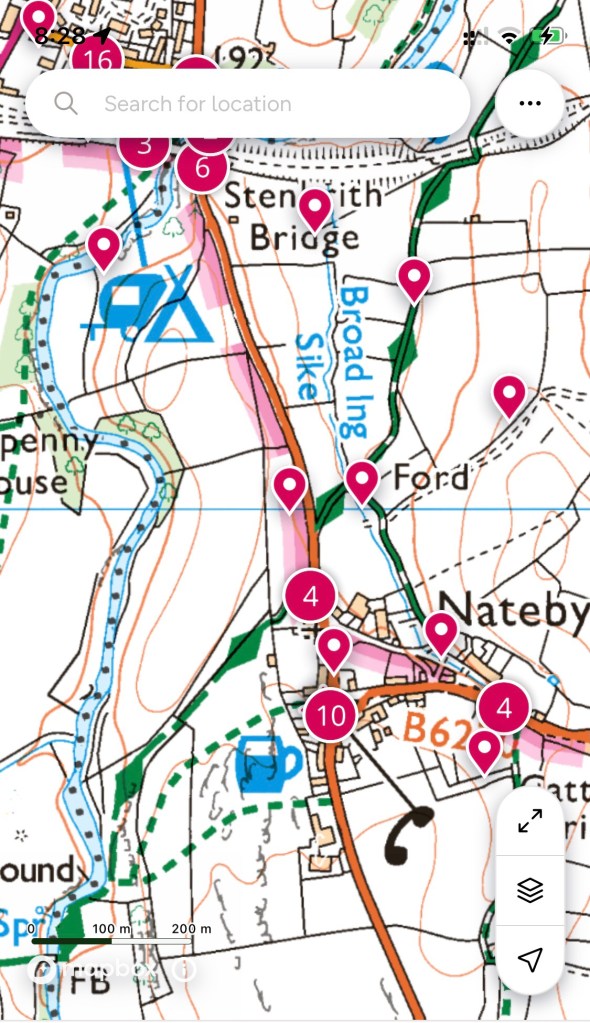
Day 10: Kirkby Stephen (Nateby) to Keld (Frith Lodge)

It looked simple on the plan, really. An ascent to the highest point for the rest of the journey, then a descent into Keld, with a detour because again our accommodation wasn’t actually in Keld.

But when reading about what was ahead, it was clear that we’d be needing gaiters. Because, even though you may have picked up from my earlier writings, England is a damp country, today was going to be a bit special in that regard.

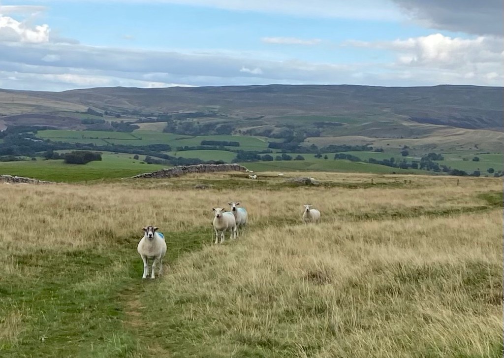
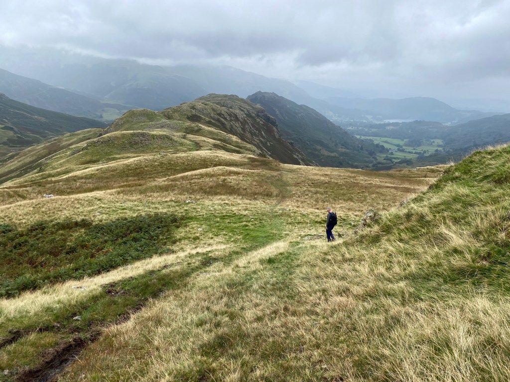
So first up, the ascent. Winding its way through farmland again, it became obvious that my faithful hiking boots were not as waterproof as they once had been. I think I’ve had them for four years, and for most of that time they laughed at puddles. Now I’m finding that I can’t walk through a grassy meadow on a dewy morning without starting to get that sinking feeling through the edges of my socks. Not that this was going to be even slightly relevant today because I would have got wet socks even if I was wearing knee high gum boots. Our goal was the Nine Standards Rigg, which meant nothing to me at all except that I knew it was very high and there were some stones at the top.

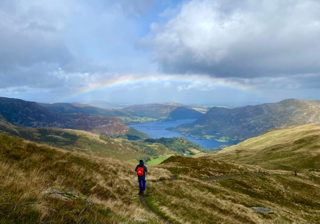
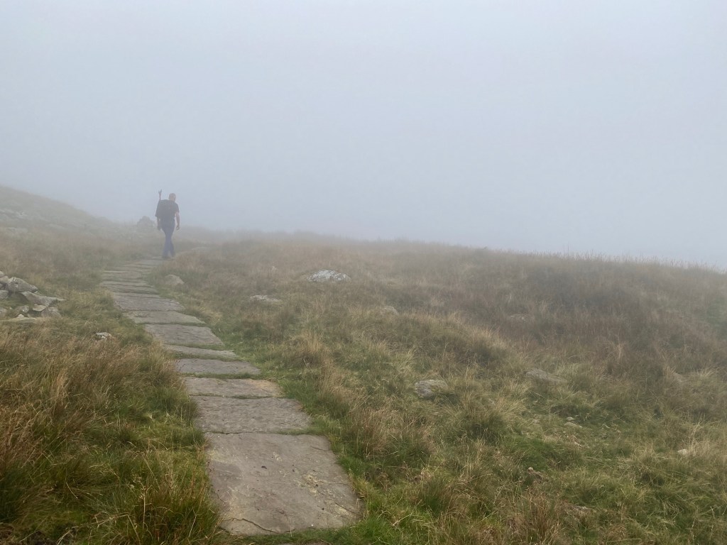
As we got up to a point where we could look back over the picturesque English countryside it did seem that the going was pretty wet under foot. There were spots where the track disappeared into a morass of mud where clearly walkers were picking their way around the sides to find ways up. We did start to get glimpses of the Nine Standards, and they got more mysterious the closer we got to them.

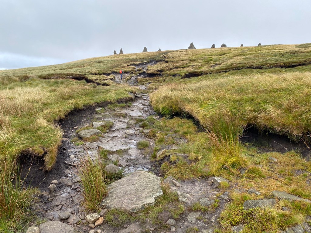
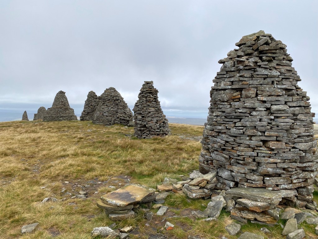
They weren’t stone monoliths, they were constructed like a stone wall but in all different shapes. Google has nothing useful to say about them. Wainwright thought they were ancient, though some have been repaired over time. There might be an eighteenth century record of them, but no one is quite sure. I don’t know why they are called ‘standards’. I would have like to have spent more time photographing them, but there was a howling wind going on so we moved on.

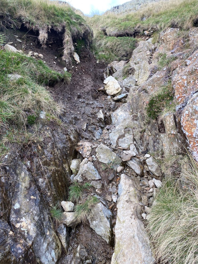
A bit down the track came a decision point. There were three possible routes down the Dales to Keld, and they were season dependent. The easy route was green. Wainwright’s route was red. The route recommended for this time of year was intermediate between the two and coded blue, and we decided to do that. Something that Wainwright entirely failed to mention, and something the proper guidebook went on about at length was that the full descent was a giant peat bog. There were posts at intervals to help you navigate, but apart from that you were on your own.

So down we went, with the fierce wind at our backs. The going was squashy and at regular intervals we would need to cross some kind of mixture of moss, reeds, mud and water and use our judgement for where to put our already soaking wet boots.

Peat bog in the Yorkshire Dales

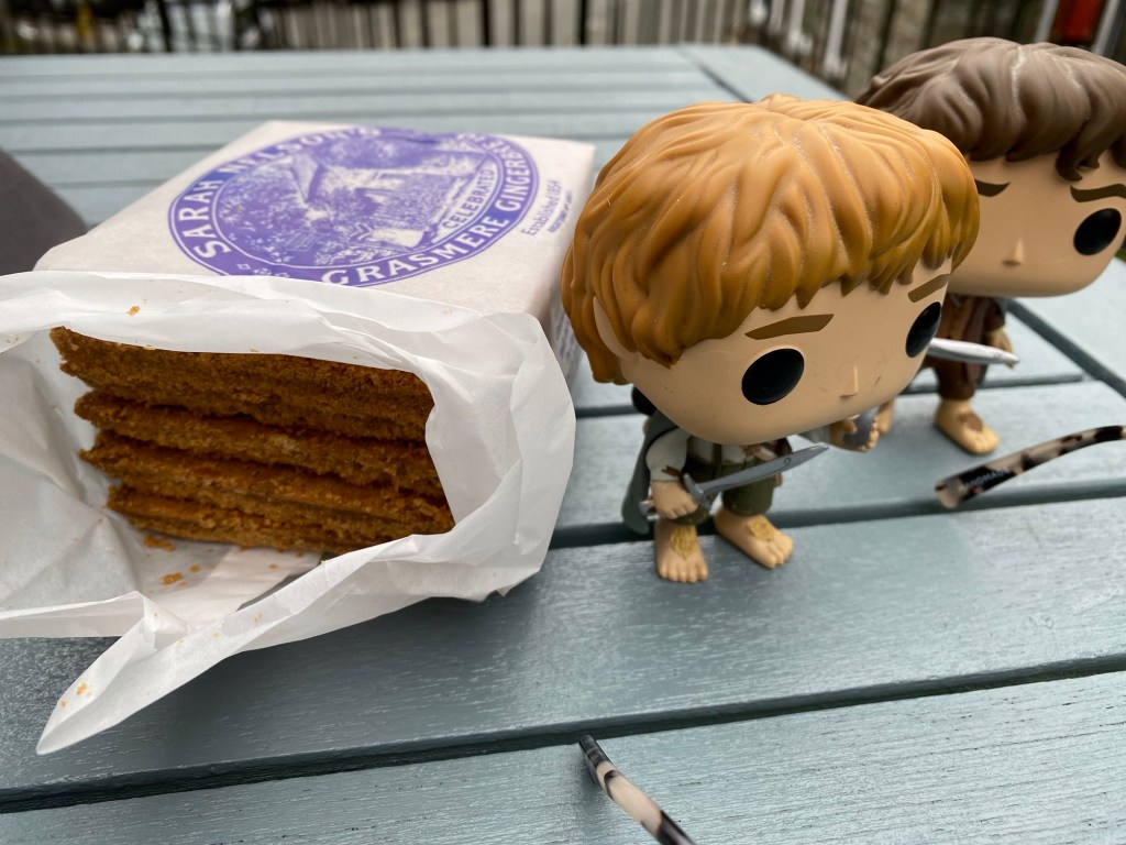
It went on for a very long time, sometimes struggling through tussocky grass and heather clumps, mostly yanking our boots out of the sucking mud. We eventually came across a corner of ruined fence out of the wind to lunch on the last of the Grasmere gingerbread.

A sheltered spot to eat lunch

I thought I’d got the hang of it by then, never step on the bright green moss or the fine grass, stick to stepping into clumps of reeds… when I put a foot wrong. I was just at the bank of one of these crossings when my left leg sank into the bog up to my thigh. I threw myself onto the bank and managed to pull myself out, but I certainly hadn’t felt a bottom to that hole and you’re lucky you’re reading this blog instead of waiting five hundred years to read about the discovery of my mummified remains in which the final snack was determined to be a chunk of Kendal Mint Cake.

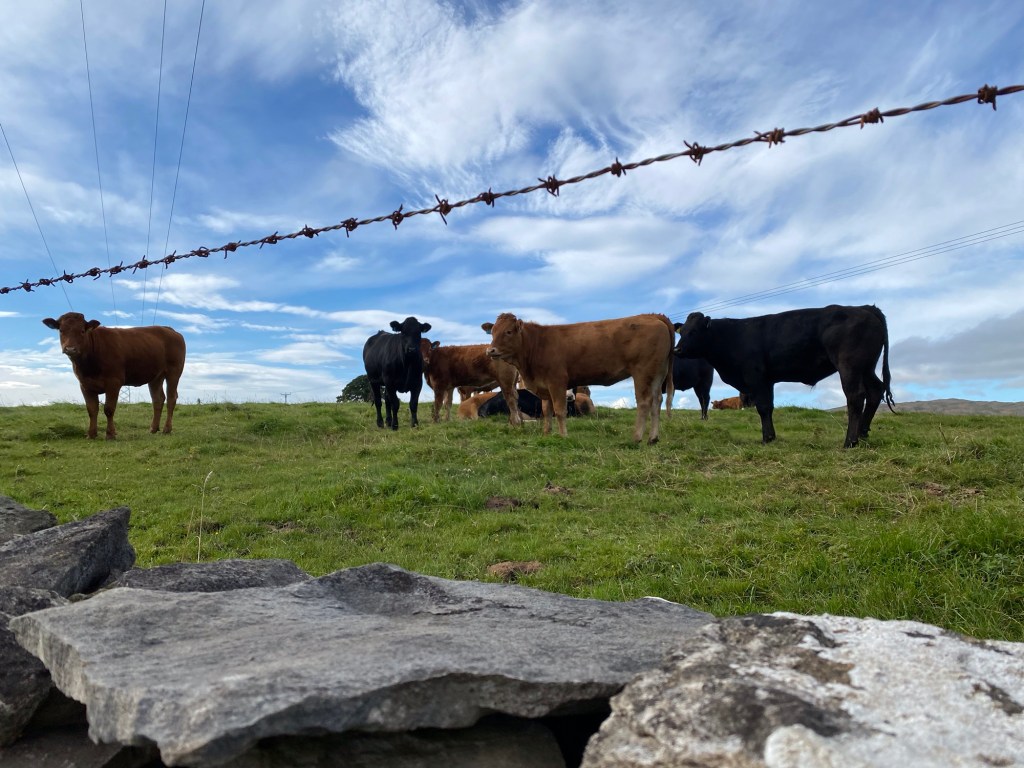
Even after we were out of the bog proper and back onto routes taking us past farms, bits of bog would still pop up into the path. I used to think it was amazing when they’d find an ancient human body in a peat bog, now I think it’s just because there’s so much bog they haven’t explored most of it because it’s quite unpleasant. I’m surprised they don’t lose more hikers in it.

Our final destination was Frith Lodge, very well signposted from our track. It’s situated high on a dale on the Pennine Way, and we could see it from such a long way away that we felt like we were walking towards it for hours and never getting nearer. Karen, our host, said that’s what everyone says. She saw us dragging ourselves up the steep driveway and had the door open to welcome us in. She saw the state of me (I’d also fallen a few times in the slippery mud) and very kindly suggested that we might like to chuck our bog saturated clothing in her washing machine.

I might have more to say about Frith Lodge, it’s a lovingly renovated 300 year old Dales longhouse, and Karen and Neil are very kind hosts. All guests had dinner, cooked by Karen, around the one table and exchanged walking tales. One woman was walking from Lands End to John O’Groats and it would take her three months. We met a couple from Oregon that we’d seen at other lodgings out of the corner of our eyes, also doing the Coast to Coast. We’ll probably catch up with them in Richmond. It’s beautiful accommodation and I must try to take some photos of it tomorrow, because it’s made it into the top three for us out of some pretty strong contenders. If only it had had an open fire.

Day 9: Orton (Tebay) to Kirkby Stephen (Nateby)

Today felt like a bit of a linking day. Getting the feet to get us moving along to the Yorkshire Dales. Actually we popped in and out of the eastern end of the Yorkshire Dales National Park today and spent a bit of time on the Dales Highway – Wainwright wasn’t above appropriating existing trails to connect up the dots. Twenty eight kilometres all up, but not particularly taxing (although my left quad would beg to differ, I don’t know what I’ve done to it).

It wasn’t without its small dramas. Getting from Tebay back onto the Coast to Coast track had the Commander in full navigation mode, guiding us over frost covered fields (it’s SUMMER!!) with unerring precision, meeting various barnyard animals that looked like they came out of a Schleich pack. I even got half heartedly charged by a bull calf as I clambered over a stile. We rejoined the track at the Neolithic Gamelands stone circle, another unremarkable collection of rocks in a field unless you knew what they were. At least this one had an informative sign.

Gamelands Stone Circle

But this meant that by the time we got to the extremely misleadingly named Sunbiggin Cafe (a collection of picnic tables out the back of a farm, no facilities whatsoever), his phone was very low on battery. Which is when we discovered that the iPhone 15 is very picky about cords and power banks, and basically we couldn’t charge it. It got put into low power mode to preserve the Strava record and we moved to plan B which was to use my phone to navigate.

I was fired almost immediately. We met a jolly Kiwi group at the picnic tables and I blithely followed them along what looked like a major track and up a hill before I was asked if my blue dot was on the blue line. Dear reader it was not anything like. I had my phone removed from me and got navigated back onto the track (with the Kiwis trailing sheepishly behind us) for quite a slog across somewhat featureless grassland and moors.

I eventually regained navigation privileges, and decided to stick to using the travel agent app, which meant that all I had to do was to keep our blue dot on the blue line and check it a lot more frequently than I had been – this track is not completely signposted yet. The Commander prefers the ordnance map app, which I find completely overwhelming – here’s an example:

Ordnance map app of the vicinity of Nateby

Eventually we finished crossing the moors and got a lovely view over our next section of walking, stared down by sheep and surprised by more military aircraft manoeuvres.

It got a lot more scenic from here, with a perfect stone bridge, a distant viaduct, and a picturesque railway station.

Once again, our accommodation was booked a few kilometres off the track, which gave the Commander a marvellous opportunity to get out the paper ordnance maps he’d printed out a lot earlier to once again unerringly navigate us to the Black Bull at Nateby hotel. I don’t know how he does it, it just looks like a lot of squiggles to me, but we went down a cycle path, across some fields, over a stile, through some gates, across a bridge, some more fields, up a grassy bank to a stile over the town wall and there we exactly were. Back into classic English pub territory, this one is lovely with giant black beams crossing all the ceilings and serving the usual Cumbrian pub list of fish and chips (which we shared, it was just what we needed), some form of pie, sausage and mash, and a burger. They were also branching out into what looked like a version of chicken parmi, but nothing an Australian would recognise. Got to go rub some Voltaren on my leg, we’ve still miles to go.

Day 8: Shap to Orton (actually Tebay)

We’re out of the Lakes District now, and that means no more mountain climbing (well for a bit anyway, I haven’t read very far ahead). And that meant that today, even though we ended up walking about eighteen kilometres, we ended up at our hotel a touch after 3pm with joints intact.

Most of the morning was walking over farmland, which meant the most luscious green grass you’ve ever seen, not a tree in sight, still dodging bogs, and an array of cows and sheep.

Cows outside of Shap

We crossed over the A6 on a high footbridge, Wainwright notes that this signifies a third of the walk done. We skirted around a giant limestone quarry. We’re on limestone country now, and a lot of the time you feel like the limestone bones of the country are sticking up out of the grass you’re walking on. There was the odd diversion suggested from one of the apps. A Neolithic stone circle was first up, just sitting in the middle of a field, no sign or anything. We couldn’t distinguish it from other chunks of limestone sticking out of the field until we were right upon it.

Neolithic stone circle

The app had details of the type of stones represented, there must be lots of this kind of thing all over the place, just existing in fields as they’ve lain for thousands of years after their people disappeared. Another item on the map app was Robin Hood’s grave. The app notes that it absolutely isn’t Robin Hood’s grave, but doesn’t suggest whose it actually is. Again, no signs to it, no information, just a cairn existing in a tiny valley.

Robin Hood’s grave

The farmland gradually gave way to a spot of heather covered moor for a bit, still almost no trees.

Track through the moor

Wainwright suggests pushing through from Shap to Kirkby Stephen, but as that is a distance of about thirty kilometres on top of the taxing previous day, people are starting to cut that in half by stopping off at Orton. Orton is a bit of a way off the Coast to Coast track, and the accommodation we’ve been booked into was further still. So the Commander, who comes out in hives if he has to retrace his tracks, decided to take a shortcut down to Orton, followed by a devious route through to Tebay where our hotel is, so that tomorrow we can walk back up the route the travel agent suggested to rejoin the track without the horror of seeing the same grass twice. Orton is a tiny village with a lovely little church and an outstanding chocolate shop and cafe, where we lunched on scones and crumpets.

The cafe in Kennedy’s chocolate shop in Orton

The hotel at Tebay, on the other hand, is behind a service centre on the M6. The hotel itself is that kind of plushy corporate style which is very comfortable and you can’t see the motorway, but I have been enjoying the madly quirky accommodation of previous nights. It is attached to a farm shop that is in the service centre which is insanely fantastic and makes me even more resentful of the filthy soulless nightmare that is the Taree service centre on the Pacific Highway in NSW. It had a diner serving food made with local ingredients, a butcher, a deli, the most incredible range of snacks and drinks, local crafts, walking gear, a full range of wines and beers, fresh baked goods. I’ve noticed in England that if you have a dog, you can take it pretty much anywhere and this place had a range of dog clothes, dog snacks, and an enormous dog walking area behind it that was basically a wood. The hotel welcomes dogs too, there’s a section of the restaurant for guests with their dogs.

The one thing none of the accommodation seems to have is a washing machine. There were a stack of bags in the lobby when we checked in, so a lot of people doing the Coast to Coast in the same way we are – with our bags mysteriously disappearing in the morning and materialising at our next place of rest – and we turn up covered in mud. Does nobody think that perhaps we’d like to wash our clothes in a machine at some point rather than clog up their bathroom sinks with dirt and grass seeds?

Day 7: Patterdale to Shap

Today had it all. A big climb, a steep descent, amazing Lakes District views, lots of sheep, long traverses, rain, wind, sunshine, hail and a ruined abbey.

It was also large kilometrically – twenty five kilometres which took us from 9am to 6:30pm to get done. We left beautiful Patterdale, one of those ridiculously picturesque Lakes District villages full of stone walled cottages, and started the climb to Kidsty Pike. I’m not sure if I’m getting used to this, or it was a particularly kind climb, but even though it took us some hours I didn’t really have a problem with it. We made sure to look back often, as we were leaving the Lakes District.

View back down to Patterdale

The wind picked up as we ascended, but at no stage did I feel like I’d be blown into a mere. Or a tarn. When we got to Kidsty Pike we found a small sheltered area out of the wind to eat our gingerbread lunch, where we were treated to a view of four fighter jets doing some kind of twisty formation thing through the peaks across the valley from us. The Commander went back up to the peak to take a panorama and was astonished to be engulfed in a hail storm, as was I. Glad we already had our raincoats on. It probably only lasted five minutes.

The descent down was really more like climbing down a series of small cliffs, often having to take them backwards. This thing is going to be a national walk next year, I am wondering if they are going to make some of these tracks that are really only visible on one of the multitude of map apps on the Commander’s phone into actual paths. Here is an example of part of the descent ‘track’:

The descent from Kidsty Pike

Eventually we got down to Haweswater Reservoir, and the next bit was to walk the length of it along a cliff traverse. It was a little tough going, a very narrow track, often rocky or wet, and no red squirrels, sadly. After that there were tracks across farmland, meeting fat white sheep that would have been no match for the Herdwick sheep of the highlands. After a lot of walking, we came across our very first significant ruin, Shap Abbey.

Shap Abbey

Shut down by Henry VIII in the mid fifteen hundreds, the floor plan of the place is still visible beyond the very impressive tower. As it was already six pm by the time we got here, we had a very quick wander around this fabulous place before heading on to Shap, which is not nearly as picturesque as we’ve been used to despite the magnificent rainbows heralding our approach. Our place for tonight is the New Ing Lodge, who have humorously put us in an attic room up three flights of stairs.

With a tummy full of pie and merlot from the nearby Crown pub, some Voltaren and magnesium pills added to the mix, I’m sure I’ll sleep well.

Day 6: Grasmere to Patterdale

Again, one of those not physically demanding days, but…

So we really loved Grasmere, the beautiful stone buildings, the way the locals called you pet, love, darling, my sweetheart in a really genuine way despite probably seeing thousands of visitors every year. It was raining in the morning, so we decided on a slightly later start and lingered over our breakfast and an actual espresso coffee.

Despite Alfred Wainwright’s disdain for the grassy walk up to Grisedale Tarn, we thought it was lovely with amazing views back over Grasmere, whose name is the town but also the lake. Our guide from a few days back, Paul, told us that in the whole of the Lakes District there was only one lake with Lake in its name, and ‘mere’ is another Viking word for lake. So it was another climb, but I’m getting better at them. We paused just below the saddle before Grisedale Tarn because the wind was getting up and we wanted somewhere sheltered to eat our lunch of Grasmere gingerbread. They carry on about the recipe, but I think what I’d really like to know is the method – this stuff has a very firm bite through the middle with a crumbly crust around it that manages to stay on – making it ideal trekking food.

Frodo and Sam in my daypack eating some Grasmere gingerbread

After Grisedale Tarn there was a choice of three ways to Patterdale – a lovely contour walk down to the valley that was obviously never going to be an option, a climb of Helvellyn which involved a walk along a ridge that Wainwright described as an exhilarating traverse, and the Commanders more comprehensive guidebook described as a death wish except in the finest of weather. We had already decided to take a third route – up to the crag of St Sunday. We did not have the finest of weather. As we walked around the edge of the tarn the wind was whipping it up almost into surf. We met an Australian couple who had started up to St Sunday and turned back because of the wind, but we pressed on. Almost up at the ridge line we met another couple turning back because of the wind. We pressed on. In short, the Commander found it exhilarating, I thought we were definitely going to get blown off into a picturesque valley to be nibbled by uncaring Herdwick sheep. The views were incredible though, and soon we were heading back down on the long descent to Patterdale.

Descending to Patterdale with Ullswater in the distance

The wind was still howling on the descent, but as we were no longer on a ridge line it wasn’t as disturbing. Squalls of rain kept passing us by, but we had on raincoats and so did our backpacks. For some reason, most of the path was actually little creeks, you can see them gleaming in the brief sunshine in the next photo.

Paths that were creeks descending from St Sunday crag

And if you went off the creek/path you’d sink into the bog. Which meant that with one thing and another, by the time we arrived at the Old Water View hotel we were quite damp and in need of physical and spiritual sustenance. Which we got in spades. The place had an ample drying room for our boots and raincoats. It had two sitting rooms with fires (yes, it is still technically summer here but today’s maximum temperature was twelve degrees). It had a serve yourself bar. They brought you a jacket potato with toppings for dinner. And apparently Wainright himself used to stay here all the time when it was the Ullswater View Boarding House.

Old hotel sign

Some American guests arrived while we were thawing out in front of the fire with some local beer. They pooh-poohed the jacket potatoes. They wanted to know why the serve yourself bar didn’t have any ice. And they said that tomorrow they would not be doing the next stage – Patterdale to Shap – because they didn’t like the look of the weather. What they would be doing was getting a taxi to Shap, doing the Shap to Orton stage which was quite short. Then the next day getting a taxi back to Patterdale to do Patterdale to Shap when the weather was better. Americans, hey. Made us feel pretty sanctimonious.

Resting in Grasmere

If you’ve been keeping up with the muttering housewife travels across England, you’ll see there’s been a lot of walking up hills and also down hills in the last three days, which has of course been delightful but also somewhat taxing on the joints and incipient bunions. The Commander, with his formidable insight, booked us a rest day in Grasmere so our bodies could process what we’d been doing to them and also we could catch up on what one’s PhD student has been up to and maybe do a spot of washing.

Grasmere is a delightful little town pretty much geared to the energetic tourist trade, so runs very much to outdoors shops, galleries, tea shops, purveyors of beer and such like. And sweet little places of accommodation like where we are lucky enough to stay for two nights, Heidi’s Cafe.

Heidi’s Cafe, a stone walled lodge in Grasmere

That’s our verandah on top of the sign, where we drank beer and ate crisps this afternoon while giving feedback on a PhD chapter (me) and working out the next days route (the Commander). The room behind it is equally charming, although with an alarming number of hand painted closeups of cow’s muzzles adorning the walls.

One of at least three paintings of cow’s muzzles in our room, overlooking the bed

What Grasmere lacks, surprising in a town so accommodating of fell walkers, is a laundry. It does, however, have a seriously astonishing jigsaw shop with countless numbers of 1000 piece puzzles on any theme you could name, but also, for the connoisseur, puzzles of up to forty two thousand pieces. The weather must get terrible here.

A very small selection of the jigsaw puzzles available in Grasmere

I do like to have clean clothes, so I gathered together all of our dirty clothes for the last five days, accumulated all of our change, and caught the bus to Ambleside, a slightly larger version of Grasmere a fifteen minute bus ride southwest. The laundromat was conveniently located about thirty metres from the bus stop and thanks to Google reviews I was ready with my six pounds change for the machine, a further four pounds for the dryer, and my own laundry powder. I took a little walk around the town to replenish our supply of sweets (jelly babies and Kendall mint cake for me, wine gums for the Commander), got a superb coffee from Cafe Altitude up three flights of stairs, then bundled self and our clean dry clothes onto the top of the bus back to Grasmere before lunch and what a treat of a bus ride it was. Open to the sunny skies with a recorded commentary on the lakes and notable houses along the road and I was one of only three people up there.

Typical view from the bus from Ambleside to Grasmere

While I’d been gone, the Commander had laid in supplies of Grasmere’s famous gingerbread for the days ahead. Our accommodation always includes as much breakfast as you could possibly handle, and dinner portions are enormous so we’ve been eating lightly at lunch out on the fells. The plan is for the next few days to have ginger bread for lunch, and I can’t wait.

Grasmere Gingerbread with Sam and Frodo pop vinyls for scale

As you could imagine, there are people other than us walking across England, and one cannot help but bump into them from time to time, and that has also been lovely, swapping stories, admiring each others’ hiking socks, comparing how deeply we sank into the bog. They tend to be older people, I guess who are semi or fully retired who have the time and money to do this. Makes us think that this might be the start for us of a whole series of walking adventures. I might have to update this thought later in the trip.

Day 4: Rosthwaite to Grasmere

So something you learn when you’ve done a bit of trekking is that the kilometrage does not necessarily indicate the amount of work done on a walking day. And today was one of those days.

The whole point of walking in the Lakes District is to get up on the fells and crags and take a gander at the breathtaking views of valleys and ravines and cascades and becks while being judged by the local sheep.

Herdwick Sheep. Apparently the brown ones are young and they get paler as they age.

So today began with a short walk out of our accommodation which was in the vicinity of Rosthwaite, but not quite in it, that was almost immediately halted by a giant barbed wire gate. So, of course, we climbed over the nearest stone fence onto the track, tearing a neat little right angle into the leggings I traditionally walk in in the process.

A lovely gentle climb led us beside the Stonythwaite Beck up to a saddle under Eagle Crag.

One of the cascades of Stonythwaite Beck under Eagle Crag

So that was nice, and one of the possibilities after that was to descend into the valley beyond and wander along until you got to Grasmere. But, you would already have guessed, that’s not what Alfred Wainwright would have done. Not when there was a lovely ridge line that skirted the valley and dropped you down into Grasmere much later. Oh no.

So we kept our height and discovered that this particular track was an odd mixture of rocky path and peat bog. Sometimes the rocky path was a delightful series of giant flat stones laid regularly for tens of metres at a time. Other times it more resembled a rock waterfall for you to pick your way up or down trying hard not to think of the lady who broke her arm doing exactly this just yesterday. And then at the top of the ridge we entered into a spot of cloud.

The Commander disappearing into the cloud along a nice bit of track

So basically the entire ridge line, that Wainwright lightly described as a track between three crags but left out the numerous mini crags in between, took an enormous amount of concentration to navigate. And that’s what I mean by hard work – yes the climbing was a thing but the hardest thing was picking your way through the cascades of stone without twisting your ankle and ruining the expedition or sinking up to your knees in the bog. And just when you were concentrating hardest, you’d be overtaken by a fell runner who didn’t seem to have this problem.

The ridge line between Calf Crag, Gibson Knot and Helm Crag

Then it began to rain, so proper English weather at last. We’d prepared for this, so got out the raincoats and put the little raincoats over our daypacks and no problem. Except that it made the rock cascades very slippery indeed, so that slowed me down a lot, and I was in a bit of a mood by the time the Commander cheerily announced the last little crag. And this is what it looked like.

Helm Crag

Actually the climb up wasn’t too bad, but picking our way down into the valley took a picturesque age. And it just got more and more picturesque and covered in moss until we got into the town of Grasmere itself to find we’d been booked into a spectacular room behind a cafe, requiring some detective work to locate our key. Again, the joy of wandering into your accommodation after a long day’s concentrating to find your bag with its supply of Voltaren waiting for you is just magic. We nipped across the road to the 1796 pub for some pints and burgers and are feeling much refreshed, thank you very much.

Our accommodation in Grasmere

Day 3: Ennerdale Bridge to Rosthwaite

Our guide picked us up this morning from our charming hotel in Ennerdale Bridge and it quickly became apparent that our pace today would be fast. Paul was taciturn, and six foot four with proportionate legs, and he marched us along the north and more scenic side of Ennerdale Water at a similar pace that we did on our training walks around the Bay Run at home. There was something about his gait that reminded me of those Wallace and Gromit robots that inevitably go rogue and march on forever, leaving a trail of destruction in their wake. He did crack a smile when we were passed by an elderly hiker wearing stout boots a big grin and nothing else. Anyway, Ennerdale Water was lovely – I am going to have to get a thesaurus out because this part of the world is the last word in picturesque.

Ennerdale Water

At the end of the Water we stopped at a youth hostel for a toilet break and a cup of tea for the Commander. There ensued a series of negotiations on which route to take next. The Commander likes a view, and Paul the guide shared Wainwright’s disdain for paths through pine trees – which was the conventional track. He had been appraising our walking style, and thought we’d be up to it, so we ended up climbing up the side of a fell for quite some time. It was hard work and the sun continued unnaturally bright for these parts, but we did end up with some amazing views back over Ennerdale Water and forward into the Fells.

Me wearing my handmade sweat absorbing curly hair controlling headband and the Commander with a view back over Ennerdale Water

He let us stop, a little reluctantly, a bit before two just under the Haystacks fell to absorb our sandwich in record time before he had us climbing up to the very top, scrambling a little over rocks which in my opinion is preferable to trudging up the rocky tracks we’d been travelling on.

I’m not bothering putting up a photo of the view from Haystacks, it’s never going to do it justice. Apparently it was Wainwright’s favourite climb, and his ashes are scattered up here somewhere. What you can have is a view from the descent which kind of captures the kind of ridiculously scenic landscape we’re dealing with here.

Descending from Haystacks into Borrowdale (eventually)

I was pleased that we decided to contour around to the Honister Slate Mine rather than descend into a valley (Buttermere? I’m sure there was some mention of Buttermere) and back out again because I’m not fond of the climbing. I realise what I’ve signed up for, and appreciate the results when I have climbed and the associated feeling of accomplishment, but that doesn’t mean I like it at the time. What is it with slate mines and adventure experiences? There was one in Wales as well on our last visit to England. We didn’t stop to investigate, because that wasn’t Paul’s style, but started the long descent into Rosthwaite, our stop for tonight. I did manage to extract some information from Paul when I caught up to him – that the whole fell, beck, tarn, thwaite thing is Viking. Apparently they were in the region for ages, and clearly did quite a lot of geographical naming before the Normans eventually got rid of them. I had been wondering.

Our walk today was very very rocky indeed, there was no point using the poles. The rocks here are sharp, not the soft sandstone rounded ones we’re used to in Australia, and our feet are feeling it tonight. The whole pub crawl aspect of the trip is proving to be delightful, it’s quite something to walk up to your accommodation to find your luggage waiting and all you need to do is decide on a beer. My health app suggests I’ve walked twenty three kilometres and burned over nine thousand kilojoules today, so I think I’ve earned it.

Day 2. St Bees to Ennerdale Bridge

Should one not start with day one? I don’t want to get myself all confused, so I’m going with the timing of our travel agents, who are counting the trip from London to St Bees as Day 1. And most of that was on two trains, so I’m sure you have no interest in that.

St Bees was lovely, built from local red sandstone and home to a twelfth century priory that has been lovingly restored thanks to funds from the very successful posh school adjacent to it. Apparently a beach town, well there is a beach and there is the Irish Sea. There’s even sand on the beach, and the size of the car park indicates that holidaymakers flock here to paddle in a sea that to our eyes just doesn’t do anything at all. It kind of ebbs a bit, and then in sharp contradistinction, flows a bit. It seems very unlikely to kill a tourist. All we needed to do with the sea was to walk out along the sand to where it was ebbing and flowing and wet our boots in it – a suggestion of Alfred Wainwright’s. A later tradition also has you picking up a pebble to drop into the sea at the other side, so we did that too.

A large choice of pebbles on a beach at St Bees with the Irish Sea far out over the sand.

After that it was up onto the headland (you can see it in the above photo) to start walking across England. Our goal was Ennerdale Bridge, which is slightly annoyingly a 22 minute car drive away. However Alfred Wainwright was a fan of the scenic and also spending a lot of time away from your wife (not applicable here), so we walked seven kilometres along the coast along a beautiful cliff walk before turning inland.

The walk to Ennerdale Bridge took us through some gorgeous countryside, over stiles, past sheep and cows, through some very unremarkable ex-coal mining villages which seemed to consist entirely of terraced cottages – no shops or pubs or village squares or fountains or anything that would make it worth living there. Past an entirely unexpected emu farm.

One of several emus we spotted on our walk

And eventually up Dent Hill, a bit of a slog that had me thankful for all the training we did. From the top one got a full 360 degree panorama of the surrounding countryside. Legend has it that you can see the Isle of Man from this vantage point, but not on a day like today which was of almost Australian warmth and sunniness but very hazy. Very difficult to photograph, so what you cop is the descent which had us using our poles to save our knees for tomorrow.

Descent from Dent Hill

Wainwright’s guide book suggests that you pop down off Dent Hill, follow the Nannycatch Beck for a bit, go past the fake stone circle, and there you are at Ennerdale Bridge. But I’m fairly sure that was a good 7-8km, which brought my personal walking total for today up to 25km. The gazetted amount for today was 22.5 km, which is a fairly long walk and we’ll have a few days of that length. Like tomorrow. Apparently we’ll be wandering about the fells, which was a personal favourite of Wainwright, but for tomorrow only we get a guide. Which means there will be no comparing the two guidebooks we have with the travel agent’s app and the ordnance maps to work out what the gate on the left at the top of the pasture could possibly be. Apparently the Coast to Coast walk will be a proper listed walk next year which means signposts (and hopefully more than the zero toilets on the route today), but we’re not there yet. Part of the charm, though, has been wandering through fields and the back buildings of farms, and getting out of the way of a couple of farmers on a tractor who were up for a chat but had such an incredible accent that all I could do was to try to commit it to memory (not successful). They cheerfully blocked us out of a laneway we were about to walk up with a giant gate which they secured with blue string, and I think the idea was that it was to stop a cow that was on its way and we would have no trouble climbing over the gate (incorrect).

I shall end today (writing to you from the Shepherd’s Arms in Ennerdale Bridge after a long hot shower) with a note on the plant life I’ve encountered today. English plants are low key violent. On the cliff walk there were any number of scratchy plants: blackberry cane, thistles and a bunch I couldn’t identify. Inland we encounter a holly hedge that went for almost a kilometre. But there was a plant that I didn’t end up clocking that if you brushed against it gave you a good two or three hours of burning itch. That was my least favourite, and I’ll have to find out if there’s some kind of cream or hilarious remedy against it because I did not enjoy that sensation. Maybe tomorrow’s guide will know. I wonder if he’ll have a bottle of malt vinegar or a mustard plaster in his first aid kit against it? I’ll let you know tomorrow.