Day 9: Orton (Tebay) to Kirkby Stephen (Nateby)
Today felt like a bit of a linking day. Getting the feet to get us moving along to the Yorkshire Dales. Actually we popped in and out of the eastern end of the Yorkshire Dales National Park today and spent a bit of time on the Dales Highway – Wainwright wasn’t above appropriating existing trails to connect up the dots. Twenty eight kilometres all up, but not particularly taxing (although my left quad would beg to differ, I don’t know what I’ve done to it).
It wasn’t without its small dramas. Getting from Tebay back onto the Coast to Coast track had the Commander in full navigation mode, guiding us over frost covered fields (it’s SUMMER!!) with unerring precision, meeting various barnyard animals that looked like they came out of a Schleich pack. I even got half heartedly charged by a bull calf as I clambered over a stile. We rejoined the track at the Neolithic Gamelands stone circle, another unremarkable collection of rocks in a field unless you knew what they were. At least this one had an informative sign.

But this meant that by the time we got to the extremely misleadingly named Sunbiggin Cafe (a collection of picnic tables out the back of a farm, no facilities whatsoever), his phone was very low on battery. Which is when we discovered that the iPhone 15 is very picky about cords and power banks, and basically we couldn’t charge it. It got put into low power mode to preserve the Strava record and we moved to plan B which was to use my phone to navigate.
I was fired almost immediately. We met a jolly Kiwi group at the picnic tables and I blithely followed them along what looked like a major track and up a hill before I was asked if my blue dot was on the blue line. Dear reader it was not anything like. I had my phone removed from me and got navigated back onto the track (with the Kiwis trailing sheepishly behind us) for quite a slog across somewhat featureless grassland and moors.

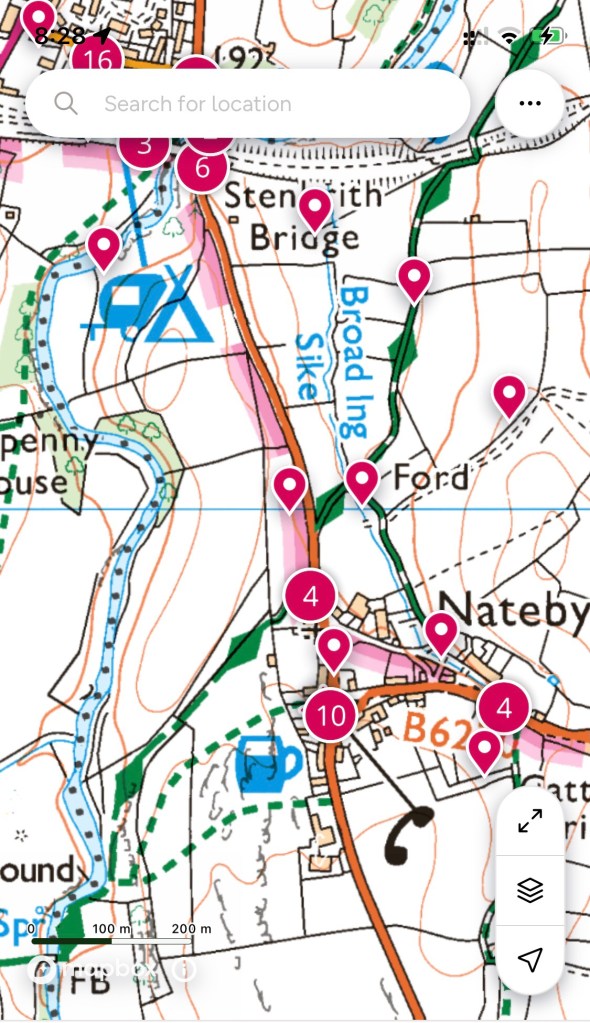
I eventually regained navigation privileges, and decided to stick to using the travel agent app, which meant that all I had to do was to keep our blue dot on the blue line and check it a lot more frequently than I had been – this track is not completely signposted yet. The Commander prefers the ordnance map app, which I find completely overwhelming – here’s an example:
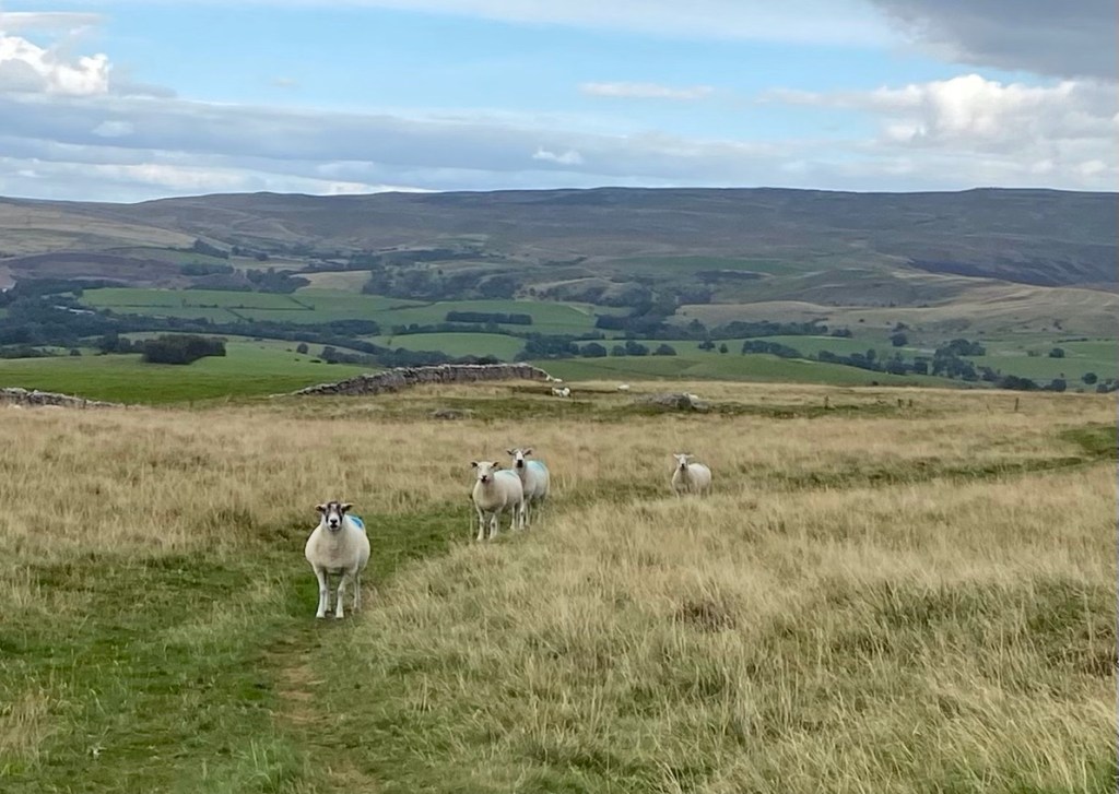
Eventually we finished crossing the moors and got a lovely view over our next section of walking, stared down by sheep and surprised by more military aircraft manoeuvres.

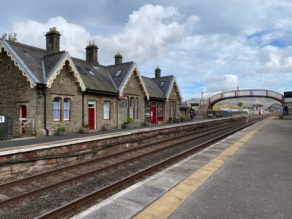
It got a lot more scenic from here, with a perfect stone bridge, a distant viaduct, and a picturesque railway station.


Once again, our accommodation was booked a few kilometres off the track, which gave the Commander a marvellous opportunity to get out the paper ordnance maps he’d printed out a lot earlier to once again unerringly navigate us to the Black Bull at Nateby hotel. I don’t know how he does it, it just looks like a lot of squiggles to me, but we went down a cycle path, across some fields, over a stile, through some gates, across a bridge, some more fields, up a grassy bank to a stile over the town wall and there we exactly were. Back into classic English pub territory, this one is lovely with giant black beams crossing all the ceilings and serving the usual Cumbrian pub list of fish and chips (which we shared, it was just what we needed), some form of pie, sausage and mash, and a burger. They were also branching out into what looked like a version of chicken parmi, but nothing an Australian would recognise. Got to go rub some Voltaren on my leg, we’ve still miles to go.
